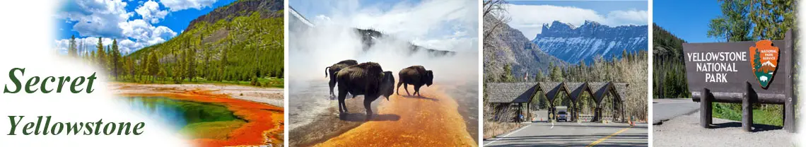
Yellowstone National Park’s physical landscape has been and is being created by many geological forces. Here, some of the Earth’s most active volcanic, hydrothermal (water + heat), and earthquake systems make this national park a priceless treasure. In fact, Yellowstone was established as the world’s first national park primarily because of its extraordinary geysers, hot springs, mudpots and steam vents, and other wonders such as the Grand Canyon of the Yellowstone River.
What Lies Beneath
Yellowstone’s geologic story provides examples of how geologic processes work on a planetary scale. The foundation to understanding this story begins with the structure of the Earth and how this structure gives rise to forces that shape the planet’s surface.
The Earth is frequently depicted as a ball with a central core surrounded by concentric layers that culminate in the crust or surface layer (see at right). The distance from the Earth’s surface to its center or core is approximately 4,000 miles. The core may once have been entirely molten, but, as the planet cooled, the inner core (about 1,500 miles thick) solidified. The outer core (about 1,400 miles thick) remains molten and is surrounded by a 1,800 mile thick mantle of dense, mostly solid rock. Above this layer is the relatively thin crust, three to forty-eight miles thick, on which the continents and ocean floors are found.
The Earth’s lithosphere (crust and upper mantle; see illustration next page) is divided into many plates, which are in constant motion. Where plate edges meet, one plate may slide past another, one plate may be driven beneath another (subduction), or upwelling volcanic material pushes the plates apart at mid-ocean ridges. Continental plates are made of less dense rocks (granites) than oceanic plates (basalts) and thus, “ride” higher than oceanic plates. Many theories have been proposed to explain crustal plate movement. Currently, most evidence supports the theory that convection currents in the partially molten asthenosphere (the zone of mantle beneath the lithosphere) move the rigid crustal plates above. The volcanism that has so greatly shaped today’s Yellowstone is a product of plate movement combined with upwellings of molten rock, as described on the next pages.
Most of Earth’s history (from the beginning to approximately 570 million years ago) is known as the Precambrian time. Rocks of this age are found in northern Yellowstone and in the hearts of the Teton, Beartooth, Wind River, and Gros Ventre ranges. During the Precambrian and the subsequent Paleozoic and Mesozoic eras (570 to 66 million years ago), the western United States was covered at times by ocean. At other times it was a land of sand dunes, tidal flats, and vast plains. Near the end of the Mesozoic, mountain building processes created the Rocky Mountains.
During the Cenozoic era (approximately the last 66 million years of Earth’s history), widespread mountain-building, volcanism, faulting, and glaciation sculpted the Yellowstone area. The Absaroka Range along the park’s north and east sides was formed by numerous volcanic eruptions about 50 million years ago. Volcanic debris buried trees that are seen today as fossilized remnants along Specimen Ridge in northern Yellowstone. This period of volcanism is not related to the present Yellowstone volcano.
Approximately 30 million years ago, vast expanses of the West began stretching apart along an east-west axis. This stretching process increased about 17 million years ago and continues today, creating the modern basin and range topography (north-south mountain ranges interspersed with long north-south valleys) characterizing much of the Western landscape.
About 16.5 million years ago, an intense period of volcanism appeared near the area now marked by the convergence of the Nevada, Oregon, and Idaho state lines. Repeated volcanic eruptions can be traced across southern Idaho into Yellowstone National Park. This volcanism remains a driving force in Yellowstone today.
Magma & Hotspots
Magma (molten rock from Earth’s mantle) rises to within a few miles of the surface in Yellowstone. This heat fuels the Yellowstone volcano and its associated hydrothermal areas. How it rises, whether or not a hotspot is involved, and the definition of a hotspot all remain the subject of much scientific research and discussion.
One hotspot theory holds that a plume of molten rock rises from Earth’s core-mantle boundary to trigger volcanic eruptions at the surface. Other theories relate the rise of molten rock to areas in Earth’s crust weakened by stretching and thinning such as that which is ongoing throughout the interior West. Some of these theories also propose a shallower mantle origin for hotspots. Still other theories define Yellowstone’s hotspot as the surface manifestation of longlived volcanism.
Regardless of its origins and subsurface behavior, the magma feeding Yellowstone’s volcano has been close to the surface for some 16.5 million years, erupting repeatedly and leaving a track of 100 huge calderas across 500 miles from the Nevada-Oregon border northeast up Idaho’s Snake River Plain and into central Yellowstone. This trail of evidence was created as the North American plate moved in a southwestern direction over the shallow magma body. Earth’s surface bulges above it, which is why the Yellowstone area averages 1,700 feet higher than surrounding regions.
About 2.1 million years ago, the movement of the North American plate brought the Yellowstone area into proximity with the shallow magma body. The heat melted rocks in the crust, creating a magma chamber of partially molten, partially solid rock (see below). Upward pressure from the shallow magma chamber caused overlying rocks to break, forming faults and causing earthquakes. Eventually, these faults reached the deep magma chamber. Magma oozed through these cracks, releasing pressure within the chamber and allowing trapped gases to expand rapidly. A massive eruption then occurred, spewing volcanic ash and gas high into the atmosphere and causing fastmoving superhot debris (pyroclastic) flows on the ground. As the underground magma chamber emptied, the ground above it sunk, creating a huge caldera known as the Huckleberry Ridge Caldera (also called the Island Park Caldera). Smaller lava flows eventually filled in the caldera over tens to hundreds of thousands of years.
The volume of material ejected during this eruption is estimated to have been 6,000 times the size of the 1980 eruption of Mt. St. Helens in Washington (see illustration next page), and ash has been found as far away as Missouri. Approximately 1.3 million years ago, a second, smaller volcanic eruption occurred on the western edge of the earlier caldera and created the Henry’s Fork Caldera. Then 640,000 years ago, the third massive volcanic eruption in central Yellowstone created the Yellowstone Caldera, 30 by 45 miles in size. Then approximately 180,000 years ago, a volcanic eruption created a smaller caldera now filled by the West Thumb of Yellowstone Lake. Yellowstone remains atop the shallow magma. The pressure and movement of the underlying heat, magma, and fluids cause the entire caldera floor to inflate and deflate rapidly (compared to more typical geologic processes).
Rising magma has created two large bulges in the Earth called resurgent domes (Sour Creek and Mallard Lake), which we see as large hills.
Sour Creek Dome, east of the Yellowstone River from LeHardys Rapids through Hayden Valley, currently has a net uplift of about 1½ inches per year. This uplift is causing Yellowstone Lake to tilt southward. Larger sandy beaches can now be found on the north shore of the lake, and flooded areas can be found in the southern arms.
From the summit of Mt. Washburn, one can look south into much of the vast caldera. The rim is also visible along the park road system at Gibbon Falls, Lewis Falls, and Lake Butte.
Future Volcanic Activity
Will Yellowstone’s volcano erupt again? Over the next thousands to millions of years, probably. In the next few hundred years? Not likely.
The most likely activity would be lava flows, such as those that occurred after the last major eruption. Such a lava flow would ooze slowly over months and years, allowing plenty of time for park managers to evaluate the situation and protect people. No scientific evidence indicates such a lava flow will occur soon.
Geyser Basin Systems
Yellowstone’s hydrothermal features would not exist without the underlying magma body that releases tremendous heat. They also depend on sources of water, such as in the mountains surrounding the Yellowstone Plateau. There, snow and rain slowly percolate through layers of porous rock riddled with cracks and fissures. Some of this cold water meets hot brine directly heated by the shallow magma body. The water’s temperature rises well above the boiling point but the water remains in a liquid state due to the great pressure and weight of the overlying rock and water. The result is superheated water with temperatures exceeding 400°F.
The superheated water is less dense than the colder, heavier water sinking around it. This creates convection currents that allow the lighter, more buoyant, superheated water to begin its journey back to the surface following the cracks, fissures, and weak areas through rhyolitic lava flows. As hot water travels through this rock, the high water temperatures dissolve some silica in the rhyolite.
While in solution underground, some silica coats the walls of the cracks and fissures to form a nearly pressure-tight seal. This locks in the hot water and creates a natural “plumbing” system that can withstand the great pressure needed to produce a geyser. At the surface, silica precipitates to form either geyserite or sinter, creating the massive geyser cones, the scalloped edges of hot springs, and the seemingly barren landscape of geyser basins.
Earthquakes
Yellowstone is the most seismically active area in the Intermountain West. Approximately 2,000 earthquakes occur each year in the Yellowstone area; most are not felt.
Earthquakes occur along fault zones in the crust where forces from crustal plate movement build to a significant level. The rock along these faults becomes so stressed that eventually it slips or breaks. Energy is then released as shock waves (seismic waves) that reverberate throughout the surrounding rock.
Different kinds of seismic waves are released inside the earth during an earthquake. Primary waves (“P-waves”) move quickly in the direction of travel, compressing and stretching the rock. Secondary waves (“S-waves”) move up, down, and sideways through rock in a rolling motion. Once a seismic wave reaches the surface of the Earth, it may be felt. Surface waves affect the ground, which can roll, crack open, or be vertically and/or laterally displaced. Structures are susceptible to earthquake damage because the ground motion is usually horizontal.
Earthquakes in Yellowstone help to maintain hydrothermal activity by keeping the “plumbing” system open. Without periodic disturbance of relatively small earthquakes, the small fractures and conduits that supply hot water to geysers and hot springs might be sealed by mineral deposition. Some earthquakes generate changes in Yellowstone’s hydrothermal systems. For example, the 1959 Hebgen Lake (see below) and 1983 Borah Peak earthquakes caused measurable changes in Old Faithful Geyser and other hydrothermal features.
Sometimes Yellowstone experiences an “earthquake swarm.” Dr. Jake Lowenstern of the Yellowstone Volcano Observatory defines this as “a packet of earthquakes close in time and space but with no large earthquakes relative to the others.” The most active swarm since 1985 began on December 26, 2008 under Yellowstone Lake, and lasted one week. More than 500 earthquakes were recorded; the largest was 3.9 magnitude. No changes in hydrothermal activity were detected.
Earthquakes help us understand the subsurface geology around and beneath Yellowstone. The energy from earthquakes travels through hard and molten rock at different rates. We can “see” the subsurface and make images of the magma chamber and the caldera by “reading” the energy emitted during earthquakes. An extensive geological monitoring system is in place to aid in that interpretation.
The Night that Woke Up Yellowstone
Twenty-seven minutes before midnight, August 17, 1959, most visitors in Yellowstone were asleep after their day’s adventures. Then a massive earthquake struck, jolting them awake.
People inside the park were lucky— rocks fell and buildings were damaged, no one was seriously hurt. West of the park, though, twenty-eight people died that night—most of them when the side of a mountain slid onto a crowded campground. Measuring at 7.5 magnitude, this quake is known as the Hebgen Lake Earthquake. The mountain slide dammed the Madison River, creating Quake Lake west of the park. Geysers and hot springs in Yellowstone changed overnight, and at least one new geyser appeared—Earthquake Geyser in the Lower Geyser Basin. It erupted 125 feet high for two weeks then settled to a low, perpetual spouting that continues today.
Glaciers
Glaciers result when, for a period of years, more snow falls in an area than melts. Once the snow reaches a certain depth, it turns into ice and begins to move under the force of gravity or the pressure of its own weight. During this movement, rocks are picked up and carried in the ice, and these rocks grind Earth’s surface, eroding and carrying material away. Glaciers also deposit materials. Large U-shaped valleys, ridges of debris (moraines), and out-of-place boulders (erratics) are evidence of a glacier’s passing.
Yellowstone and much of North America have experienced numerous periods of glaciation during the last two million years. Succeeding periods of glaciation have destroyed most surface evidence of previous glacial periods, but scientists have found evidence of them in sediment cores taken on land and in the ocean. In Yellowstone, a glacial deposit near Tower Fall dates back 1.3 million years. Evidence of such ancient glaciers is rare.
The Bull Lake Period glaciers covered the region about 140,000 years ago. Evidence exists that this glacial episode extended farther south and west of Yellowstone than the subsequent Pinedale Glaciation (described in the next paragraph), but no surface evidence of it is found to the north and east. This indicates that the Pinedale Glaciation covered or eroded surface evidence of Bull Lake Glaciation in these areas.
The Yellowstone region’s last (and most studied) major glaciation, the Pinedale, began as early as 70,000 years ago. It ended 13,000–14,000 years ago. Glaciers advanced and retreated from the Beartooth Mountains, scouring the landscape we know today as the northern range. Glacial dams backed up and released enormous amounts of water, contributing to the formation of Hayden Valley and the Black Canyon of the Yellowstone River. During the peak (16,000–20,000 years ago) nearly all of Yellowstone was covered by a huge ice cap 4,000 feet thick (see above). Mount Washburn and Mount Sheridan were both completely covered by ice. This ice cap was not part of the continental ice sheet extending south from Canada. The ice cap occurred here, in part, because the hotspot beneath Yellowstone had pushed up the area to a higher elevation with colder temperatures and more precipitation than the surrounding land.
[Need pic of glacial boulder]
Sedimentation & Erosion
Not all the rocks in Yellowstone are of “recent” volcanic origin. Precambrian igneous and metamorphic rock in the northeastern portion of the park and Beartooth Mountains are at least 2.7 billion years old. These rocks are very hard and erode slowly.
Sedimentary sandstones and shales, deposited by seas during the Paleozoic and Mesozoic eras (570 million to 66 million years ago) can be seen in the Gallatin Range and Mount Everts. Sedimentary rocks in Yellowstone tend to erode more easily than the Precambrian rocks.
Weathering breaks down earth materials from large sizes to small particles, and happens in place. The freeze/thaw action of ice is one type of weathering common in Yellowstone. Agents of erosion—wind, water, ice, and waves—move weathered materials from one place to another.
When erosion takes place, sedimentation— the deposition of material—also eventually occurs. Through time, sediments are buried by more sediments and the material hardens into rock. This rock is eventually exposed (through erosion, uplift, and/or faulting), and the cycle repeats itself. Sedimentation and erosion are “reshapers” and “refiners” of the landscape—and they also expose Yellowstone’s past life as seen in fossils like the petrified trees.
Fossils
Paleobotany
Nearly 150 species of fossil plants (exclusive of fossil pollen specimens) from Yellowstone have been described, including ferns, horsetail rushes, conifers, and deciduous plants such as sycamores, walnuts, oaks, chestnuts, maples, and hickories. Sequoia is abundant,and other species such as spruce and fir are also present.
Most petrified wood and other plant fossils come from Eocene deposits about 50 million years old, which occur in many northern parts of the park, including the Gallatin Range, Specimen Creek, Tower, Crescent Hill, Elk Creek, Specimen Ridge, Bison Peak, Barronette Peak, Abiathar Peak, Mount Norris, Cache Creek, and Miller Creek.
Petrified wood is also found along streams in areas east of Yellowstone Lake. The most accessible petrified tree site is on Specimen Ridge. The first fossil plants from Yellowstone were collected by the early Hayden Survey parties. In his 1878 report, Holmes made the first reference to Yellowstone’s fossil “forests.” The report identified the petrified trees on the north slope of Amethyst Mountain opposite the mouth of Soda Butte Creek, about eight miles southeast of Junction Butte.
Around 1900, F. H. Knowlton identified 147 species of fossil plants from Yellowstone, 81 of them new to science. He also proposed the theory that the petrified trees on the northwest end of Specimen Ridge were forests petrified in place.
Another theory proposes that the trees were uprooted by volcanic debris flows and transported to lower elevations. The 1980 eruption of Mount St. Helens supported this idea. Mud flows not only transported trees to lower elevations, they also deposited the trees upright.
Cretaceous marine and nonmarine sediments are exposed on Mount Everts. The area is under study; fossil leaves, ferns, clam-like fossils, shark teeth, and several species of vertebrates have been found. In 1994 fossil plants were discovered in Yellowstone during the East Entrance road construction project, which uncovered areas containing fossil sycamore leaves and petrified wood.
Fossil Invertebrates
Fossil invertebrates are abundant in Paleozoic rocks, especially the limestones associated with the Madison Group in the northern and south-central parts of the park. They include corals, bryozoans, brachiopods, trilobites, gastropods, and crinoids. Trace fossils, such as channeling and burrowing of worms, are found in some petrified tree bark.
Fossil Vertebrates
Fossil remains of vertebrates are rare, but perhaps only because of insufficient field research. A one-day survey led by paleontologist Jack Horner, of the Museum of the Rockies, Bozeman, Montana, resulted in the discovery of the skeleton of a Cretaceous vertebrate. Other vertebrate fossils found in Yellowstone include:
- Fish: crushing tooth plate; phosphatized fish bones; fish scales; fish teeth.
- Horse: possible Pleistocene horse, Equus nebraskensis, reported in 1939.
- Other mammals: Holocene mammals recovered from Lamar Cave; Titanothere (type of rhinocerus) tooth and mandible found on Mt. Hornaday in 1999.
